Temperatures Continue to Surge in Record-Breaking October Globally
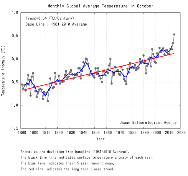
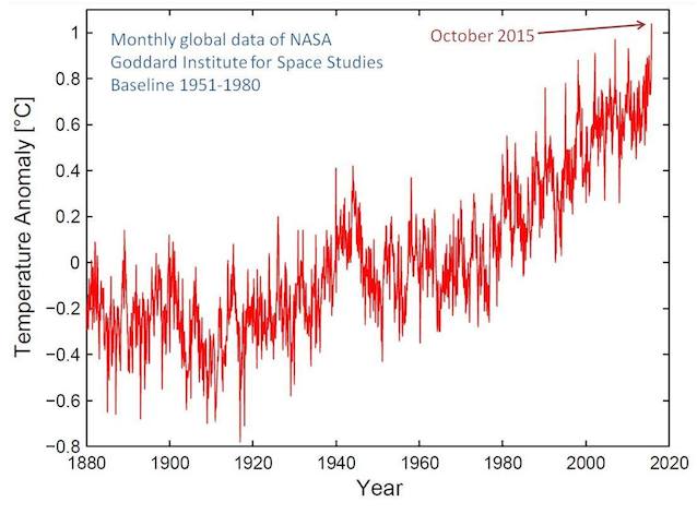
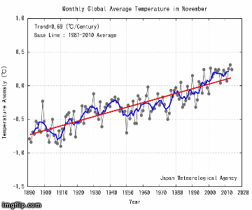
How hot was October globally? It was not merely the hottest October — by far — in the 135-year temperature record of NASA (see chart above). Or the hottest October — by far — in the 125-year temperature record of the Japan Meteorological Agency (JMA):

It was the highest anomaly — the highest divergence from the mean temperature — ever recorded in the 1,600-month temperature record of NASA (chart via Stephan Rahmstorf):

Why is it so hot? On top of the long-term warming trend caused by man-made carbon pollution is the short-term warming caused by a very strong El Niño. This is the biggest event since the super El Niño of 1997-1998 — and it may even turn out bigger (see final chart below).
It’s already the hottest 12-month period in the NASA dataset (via Greg Laden).
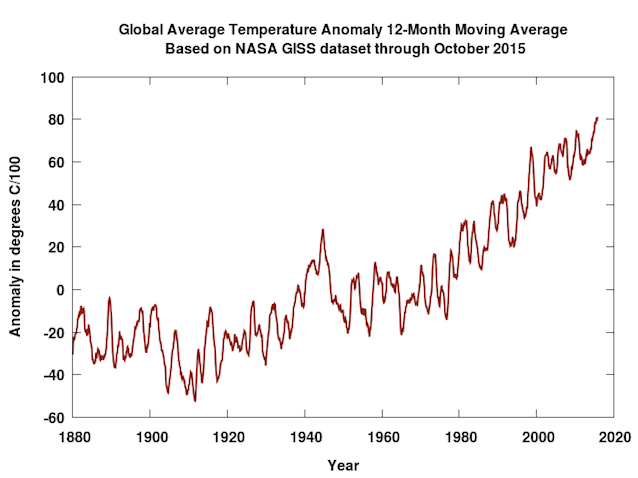

Global temperatures plotted as a running 12-month average.
Once again, the data highlight the reality there has been no actual slowdown in warming. In fact, the March study, “Near-term acceleration in the rate of temperature change,” points out the only “pause” has been in the long-expected acceleration of global warming. The rate of surface warming should have sped up over the past decade, rather than stay constant.
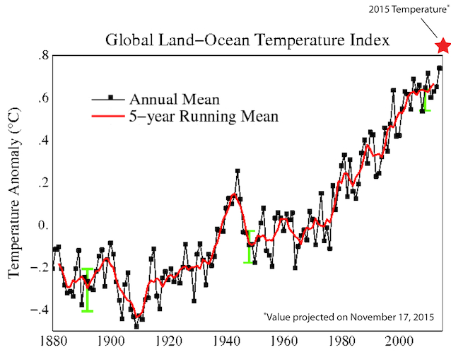
It’s now above a 99 percent certainty 2015 will be the hottest calendar year on record by far. Here is how 2015 is likely to stack up against earlier years, according to climate expert John Abraham, using temperatures through mid-November (and conservative projections through year’s end):

To see how monthly temperatures have been surging, Eli Rabett has taken JMA data showing the average monthly temperature in each month and turned them into an animated gif covering the last 12 months.

Global temperatures are surging. And temperatures will keep doing so, as this monster El Niño keeps boosting man-made warming.
NOAA data this week reveal that the Niño 3.4 region of the equatorial Pacific (which is used to measure El Niño’s strength) “has officially surpassed the 1997-98 super El Niño in terms of warmth,” as Climate Central points out.

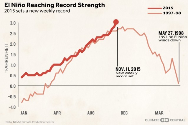
Significantly, the 12-month running mean global temperature tends to lag the Niño 3.4 region temperature by four months, as a 2010 NASA study explained. If NOAA is right that the Niño 3.4 region won’t peak until early winter, the record for the hottest 12-month period would probably not be set until spring 2016.
That means 2016 has a very good chance of beating the record 2015 is about to set. Indeed, the UK’s Met Office has noted that overall ocean trends “are consistent with a return of rapid warming in the near term.” The long-awaited speed-up in global temperature rise has begun.